
Digital Twins as System-Optimization Tools: Provisioning Edge and Cloud Infrastructure for Biodiversity Monitoring at Scale
Tanya Berger-Wolf · Operationalizing Biodiversity Digital Twins within Data Space Ecosystems
The short versionDigital twins should close the sim-to-real loop for the sensor systems too, letting teams plan where and how to deploy multimodal monitoring before going into the field.
What this was about
Tanya Berger-Wolf argued that biodiversity digital twins should model not only nature but also the sensing system itself, so that deployments of drones, camera traps, acoustic sensors, GPS tags and supporting compute, power and network infrastructure can be planned and optimised. Using a summer deployment at The Wilds conservation centre in Ohio (over 400,000 data points across five modalities), she showed a mock-up in which camera trap positions and drone flight plans can be moved within the twin. She called for bringing robotics and sensor-system standards into the same conversation as data standards and AI readiness, pointing to simulators such as WildWing.
Why it matters. At-scale monitoring (e.g. the newly announced Amazon.ia effort) depends on deploying complementary sensors in the right place and time; treating the cyber-physical system as part of the twin makes that a solvable optimisation problem.
In the room
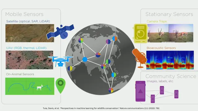
- Remote sensing, autonomous vehicles, on-body sensors, camera traps, acoustic recorders, eDNA and citizen science capture complementary signals at different spatiotemporal scales.
- At-scale monitoring requires cross-modal coordination and provisioning of compute, energy, infrastructure and sensor deployment ('sensing everything, everywhere, all at once').
- Current practice stops at data analysis; the loop should return to system refinement, using digital experiments in the twin to plan future deployments.
- The Wilds (Ohio), a large conservation science site with endangered species, was instrumented over a summer, yielding over 400,000 data points across GPS tags, camera traps, acoustic sensors, drone flights and citizen science.
- A mock-up twin lets users reposition camera traps and edit drone flight plans with full sensor details to see what the system needs to provision.
- Standards now exist for biodiversity data and AI readiness is being discussed; robotics and sensor aspects need to join the same conversation.
- Simulation environments already exist for drones, e.g. the WildWing software for drone mission planning in biodiversity settings.
Notable moments
Transcript
Automatically generated captions can contain mistakes, especially in names and technical terms. Times are relative to the room recording.
Read the transcript ↓
Related talks.
Cross-Modal Coordination for Biodiversity Monitoring at Scale: Lessons from SmartWilds
Coordinating multiple sensor modalities with AI at the far edge, informed by synchronised multimodal datasets like SmartWilds, can scale and adapt biodiversity monitoring.
Post-BioDT lessons and next-generation biodiversity digital twins
BioDT delivered pilots and, above all, mutual understanding between modellers and data people; the next generation must find real users and real conservation impact rather than chase the digital twin label.
Beyond Data Integration: Ecological and Semantic Interoperability in Coastal Digital Twins
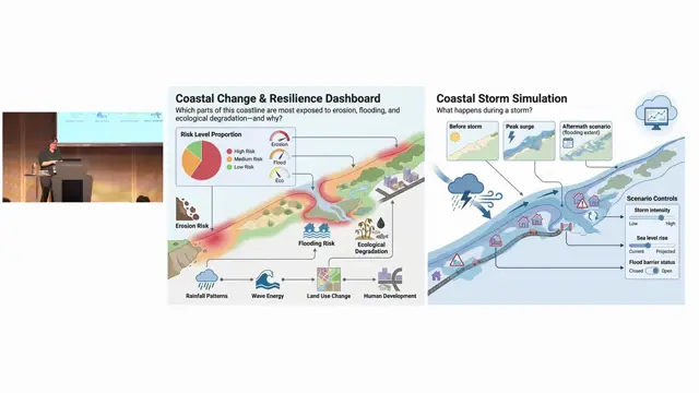
Coastal digital twins expose a long list of unresolved land-sea interoperability gaps, from vertical datums and shifting shorelines to missing cross-domain ontologies.